Via Col Pillonet, from Corgnolaz

Edited by:
Massimo Martini
Updated at: 25/07/2026
Access
Road directions
At the Châtillon–Saint-Vincent motorway exit [A5], take Strada Barat towards Via Emilio Chanoux and continue until you join thisfor 0.7 km (0.7 km). At the roundabout, take the third exit, staying on Via Emilio Chanoux for 0.6 km (1.3 km in total), then turn right onto Via L. F. Menabrea for 450 m (1.75 km in total). At the next roundabout, take the second exit and join the in the Valtournenche valley, following it for 11.1 km (12.85 km in total) to the hamlet of Buisson, in the municipality of Antey-Saint-André. Once you reach the outskirts of the village, turn right and continue for about 250m (13.0km in total) to the cable car car park, where you will find the well-signposted lower station of the regional cable car to Chamois.
Car park
There is a large car park 🅿️ at the cable car station, which is free for cable car users and subject to a charge for others. From here, take the cable car to Corgnolaz, the main village of Chamois and the starting point for the hike.
Access by public transport
You can reach Buisson by train as far as Châtillon station, on the Turin–Aosta line (Trenitalia), and then continue by private vehicle or taxi. From Buisson, the Buisson–Chamois regional cable car, operated by Chamois Servizi S.r.l., connects the valley station to Corgnolaz with regular services throughout the year. For up-to-date timetables and any special or cancelled services, please check the operator’s official website.
Distance and journey time
🕒 Journey time: 18 minutes
📏 Distance: 13.0 km
GPS navigation
Important information
The directions provided were verified on the date the route was mapped. Before setting off, we recommend checking for any changes to the route or road conditions. For up-to-date information, please consult Google Maps or Apple Maps.
Introduction
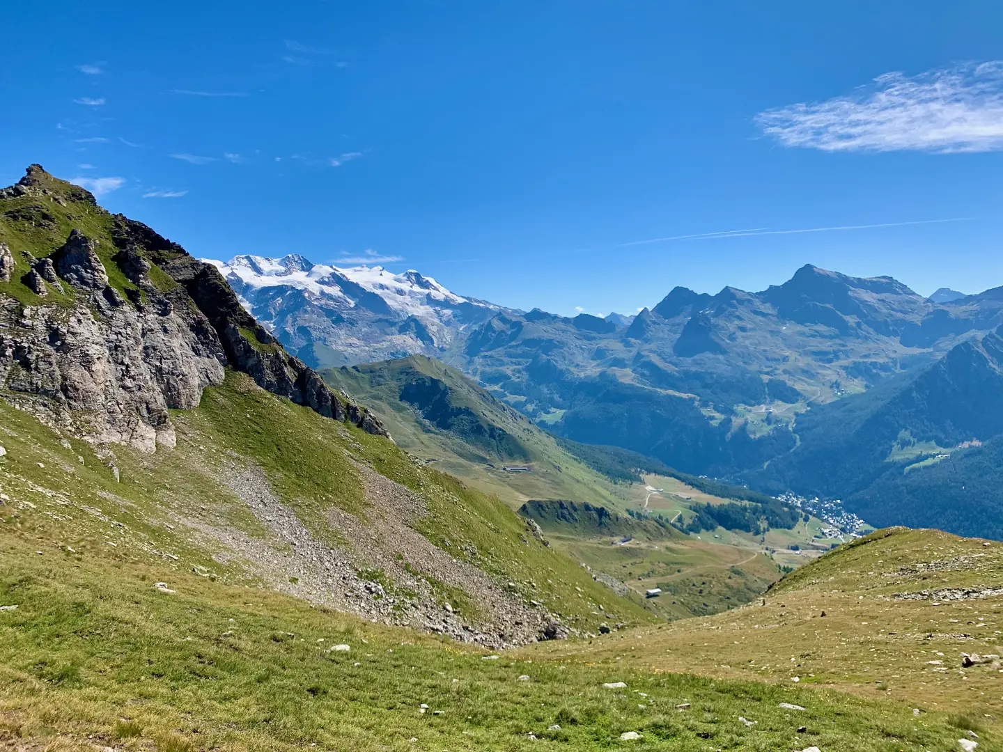
A hike that climbs from Corgnolaz, the main village of Chamois – accessible only by cable car from Buisson – up to Col Pillonet, the pass separating the lower Valtournenche from the Val d’Ayas. The route first passes through the hamlets of Crépin and Moulin, where there is a cylindrical chapel dedicated to the Transfiguration, before heading into a sparse larch forest dotted with dwarf juniper trees as far as the Les Corts mountain pasture. Beyond the mountain pasture, the landscape opens out into high-altitude meadowshigh-altitude grasslands, with the trail becoming increasingly faint. This area lies off the beaten track compared to the more popular routes in the region and offers sweeping views of the Mont Faroma massif, the Becca del Merlo, the Becca di Luseney, the Grandes Murailles, the Dent d’Hérens and the Matterhorn.
The route presents no technical difficulties but is demanding in terms of length and elevation gain, with a steeper final section near the pass. The recommended period is from June to September; in the upper section, where trail markers become sparse and the path less defined, navigation requires care, particularly in fog or poor visibility.
Description
0h00' 0.00km From the cable car terminus, cross the large grassy square in the main town and head up the road that runs through the village of Corgnolaz. Turn left shortly afterwards, then continue straight on, following the signs for Crépin (1,903m), which you’ll reach in a few minutes. Once past the village, you’ll come to a junction by a burnt-out house.
0h20' 0.77 km Take the road on the right, which descends towards the hamlet of Moulin, on the banks of the Chamois stream. The hamlet is characterised by a cylindrical chapel dedicated to the Transfiguration. Cross the bridge next to the houses and immediately take the path that climbs into the woods. After about a hundred metres, ignore a forest track on the right. Continue along the less obvious path, marked with yellow trail markers, which passes through a sparse larch forest amongst dwarf juniper bushes. At an altitude of around 1,915 metres, you’ll come across a large boulder next to a black plastic pipe that replaces an old watercourse. Climb up a short, steep little valley, then turn right onto a more clearly defined track and continue diagonally until you skirt a wide, treeless hollow. Continue along the edge of the woodland, keeping to the right-hand side of the valley. Follow the stream, wade across it and emerge from the woodland, reaching the Les Corts mountain pasture (2,185 m). Upstream of the mountain pasture, head up the right-hand side of the small stream, avoiding the farm track and following the path alongside the water. The landscape opens out into high-altitude grasslands, with the trail becoming increasingly faint. Looking back, you can make out, from the left, Mont Faroma, Becca del Merlo, Becca di Luseney, Punta and Dome de Cian, the peaks of Balanselmo, the Grandes Murailles, the Dent d’Hérens and the Matterhorn. Cross the stream again and, shortly afterwards, come to the farm track leading up from Alpe Foresus. Pass some white boulders that have recently fallen from the cliff face above. [to be completed — section lacking narrative details from the junction with the Foresus farm track to the pass: description of the terrain and orientation points are missing for approximately 2.3 km and 530 m of elevation gain] Reach Col Pillonet (2,698 m) [2h30’ T2] 4.51 km .
The return journey follows the same route taken on the ascent [1h45’T2] 4.51 km (34 m elevation gain) (890 m elevation loss).
Comments (0)
Sign in to leave a comment