Doues

Edited by:
redazione
Access
Doues can be reached via the [A5] Turin–Aosta motorway, taking the Aosta Est exit, from where you continue north along the through the Valpelline; until June 2027, the link between the motorway and the main road is closed for tunnelling works, so the journey involves travelling through the city of Aosta. Once past Roisan, the road to Doues branches off from the valley floor, climbing the hillside up to the main town and continuing towards the villages higher up. The nearest railway station is Aosta, on Trenitalia’s (TI) Chivasso–Aosta line; the section between Aosta and Ivrea is closed for electrification works and is served by replacement buses, with a phased reopening scheduled to begin in January 2027. Local public transport is operated by Arriva Italia, with suburban routes connecting Aosta to the municipalities of the Valpelline. The nearest airport with scheduled flights is Turin-Caselle’s “Sandro Pertini” Airport. During the winter months, the mountain road may have snow-covered or icy sections and requires winter tyres or snow chains to be carried on board.
Introduction
Doues is a municipality in the Aosta Valley situated at the head of the Valpelline, on a south-facing terrace that separates this valley from that of the Great St Bernard. The main town lies just over 1,100 metres above sea level, whilst the surrounding area rises through pastures and mountain pastures to the ridges of Mont Chenaille, at over 3,100 metres. The municipality borders Allein, Étroubles, Gignod, Ollomont, Roisan and Valpelline. Its position on a watershed meant that in the past it served as a junction between the two routes leading into the Valais, and even today the local economy remains tied to livestock farming and mountain agriculture.
Description
The municipal area extends along the orographic right-hand side of the lower Valpelline, from the Buthier valley floor to the Champillon basin and the ridges that separate it from the Ollomont valley. The settlement is scattered across some thirty villages and rural hamlets, including Aillan, Le Bouvier, Champsavinal, Châtelair, Condémine, Le Coudrey, La Crétaz, Dialley, Javiod, Le Lusey, Meylan, Planavillaz, Prabas and Vers-chez-Croux. As one ascends, the hay meadows and cultivated land of the lower terraces give way to wooded strips and then to alpine pastures, criss-crossed by a network of irrigation channels including the Ru du Mont, shared with Ollomont.
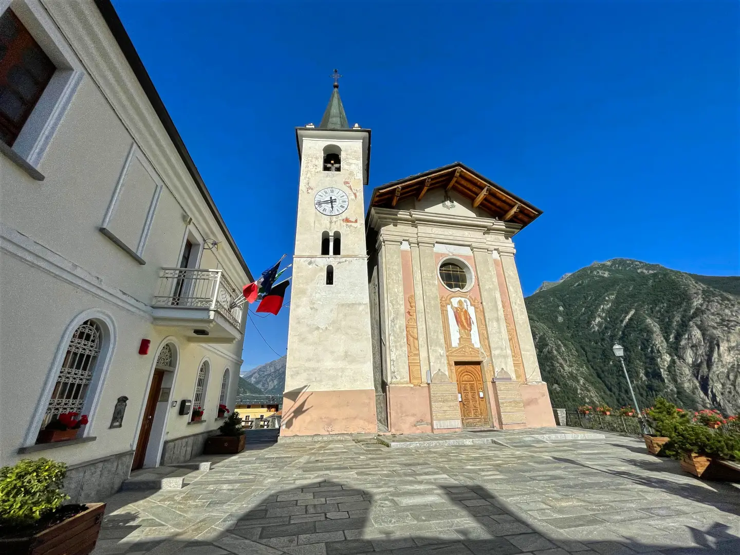
Some scholars trace the origins of the settlement back to Roman times. The place name is thought to derive from the fork in the road at Doues on the ancient route leading into the Valais: one branch climbed to the Fenêtre Durand Pass, whilst the other continued towards Allein and the Great St Bernard Pass. In the Middle Ages, the territory was a fief of the De Gignod, De La Porte d’Aoste and Dochan families, and passed from one family to another until it was emancipated in the 18th century. In 1543, Duke Charles II of Savoy appointed the de la Crête family – nobles originally from the village and already holding the fief of Allein – as lords of Doues: their coat of arms, featuring a golden roosteron a blue field, is the origin of the municipal coat of arms granted in 1998. La Crête Castle, which belonged to the Barons of La Crête and later to the Marquises of Pallavicini, has now been converted into a country house. Between 1939 and 1946, the name of the municipality was Italianised to Dovia d’Aosta, due to its phonetic similarity to the hamlet of Predappio where Mussolini was born. The parish church is dedicated to Saint Blaise.
The local economy is based on cattle farming and mountain agriculture, complemented by tourist accommodation geared towards the summer season. During Carnival, the town takes part in the ‘landzette’ parade, featuring the masks of the Coumba Freida, inspired by the uniforms of Napoleon’s troops who passed through the valley in May 1800. The village is home to palet and rebatta, traditional Aosta Valley games, and features a fully equipped OCR training course, which hosts an annual competition. Doues is part of the Unité des Communes valdôtaines Grand-Combin.
The area spans three of the Valpelline’s environmental zones. The hillside woodlands are home to roe deer (Capreolus capreolus) and red deer (Cervus elaphus), whose numbers have increased in recent years, along with the fox (Vulpes vulpes), the badger and the pine marten. Above 2,000 metres, in the Champillon basin, live the marmot (Marmota marmota), the mountain hare and alpine galliformes such as the black grouse and the rock partridge; the chamois (Rupicapra rupicapra) is found in the larch zone and climbs up to the higher slopes, where the ibex (Capra ibex). Among the diurnal birds of prey, the buzzard (Buteo buteo) ventures as far as the tree line, whilst thegolden eagle (Aquila chrysaetos) reaches the highest altitudes.
The network of footpaths climbs from the villages up to the mountain pastures and the Champillon cirque, where the Letey-Champillon mountain hut and the pass of the same name are located, linking the valley to the Ollomont valley. These same slopes are explored in winter on snowshoes and ski mountaineering equipment. One route follows the course of the Ru du Mont.
Information
General information
Area: 16.25 km²
Altitude of the main town: 1,176 m
Highest point: 3,144 m – Mont Chenaille
Population: 509 (as at 1 January 2026)
Name in dialect: Doue
Name of inhabitants: doyards
Patron saint: St Blaise, celebrated on 3 February
Neighbouring municipalities: Allein – Étroubles – Gignod – Ollomont – Roisan – Valpelline
Region: Aosta Valley<>Region: Italy <>Country: Italy <>Official website: <>Italy
Official website: municipality.doues.ao.it